
Maps may not be available
Our maps are not up to date following last year’s cyber-attack. They may not always be available. We are working to fix this and restore the service. We apologise for any inconvenience
Last updated: 16 April 2026
Carnival event maps
Download or view the event map.
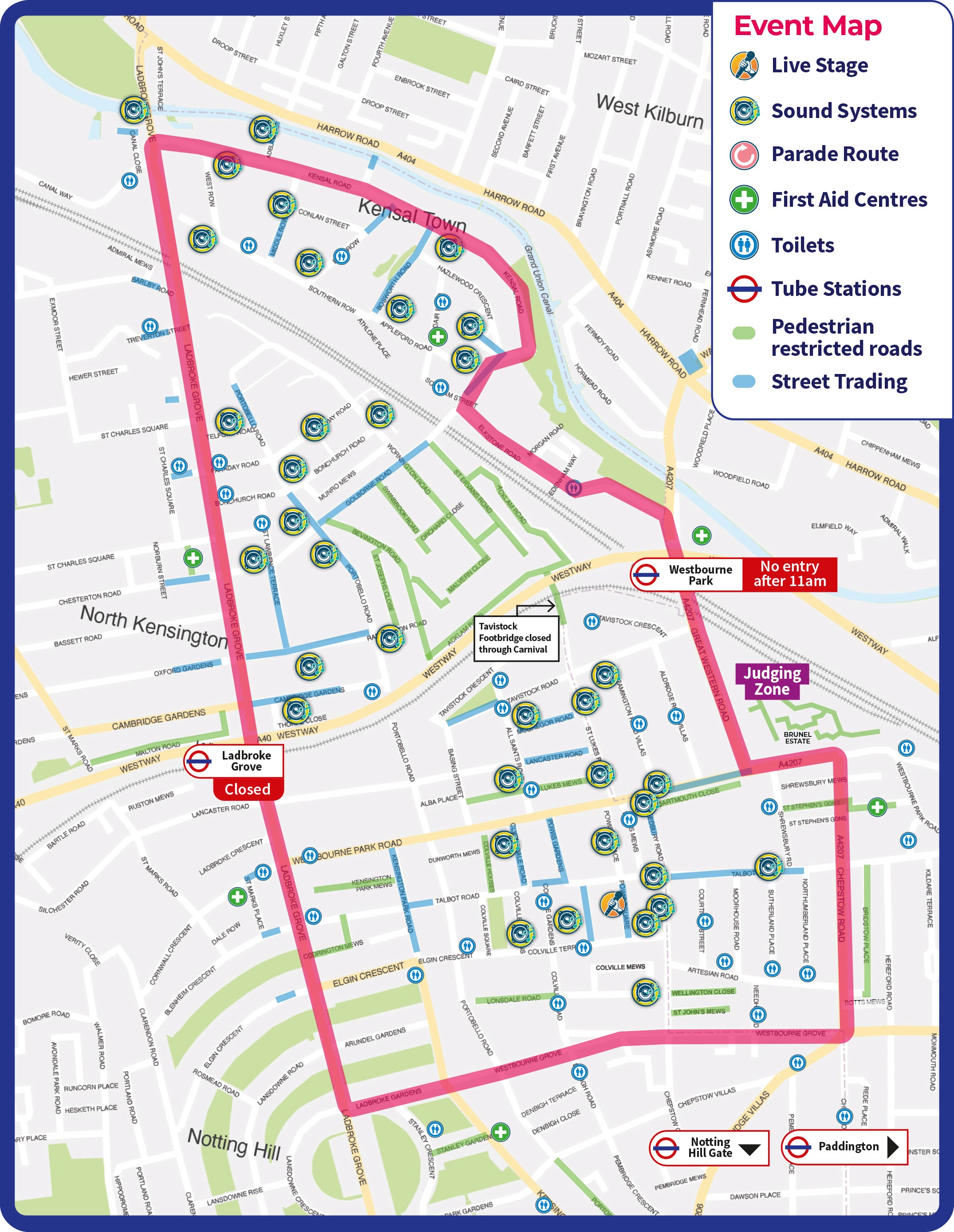
The Carnival area includes a dynamic mix of attractions and public facilities:
- The parade route: where costumes and mobile sound systems meet spectators
- Static Sound Systems: eclectic sound styles from legendary to the up and coming
- Street trading: many stalls offering delicious food, drink and Carnival accessories
- Judging Zone: where distinguished judges score parade bands
- Live Stages Popular: focal points with great line-ups of multi-generational performances, from local children to Calypsonians and surprise show-stoppers at Powis Square W11 2AY
- Medical Treatment Centres: First aid and medical support provided by St John Ambulance, the nation’s leading first aid charity
- Toilets: numerous temporary toilets across the Carnival area, including accessible units
- Pedestrian restricted access: Roads are closed to Carnival visitors to help with crowd management.